Projects
Airport Runway Rehabilitation Needs Assessment – Rankin Inlet, NU
Dillon was retained by the Government of Nunavut to perform a Needs Assessment for the rehabilitation of the Runway 13-31, Taxiway A (Alpha), Taxiway C (Charlie), Apron A, and Apron C of the Rankin Inlet Airport.
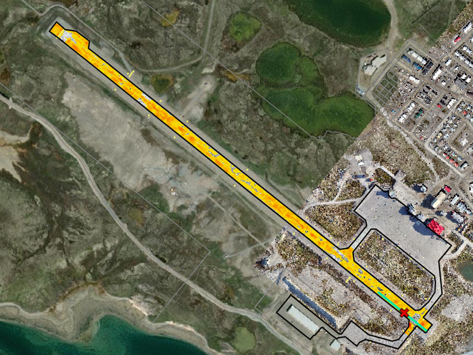
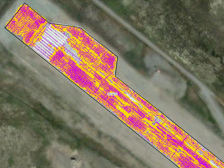
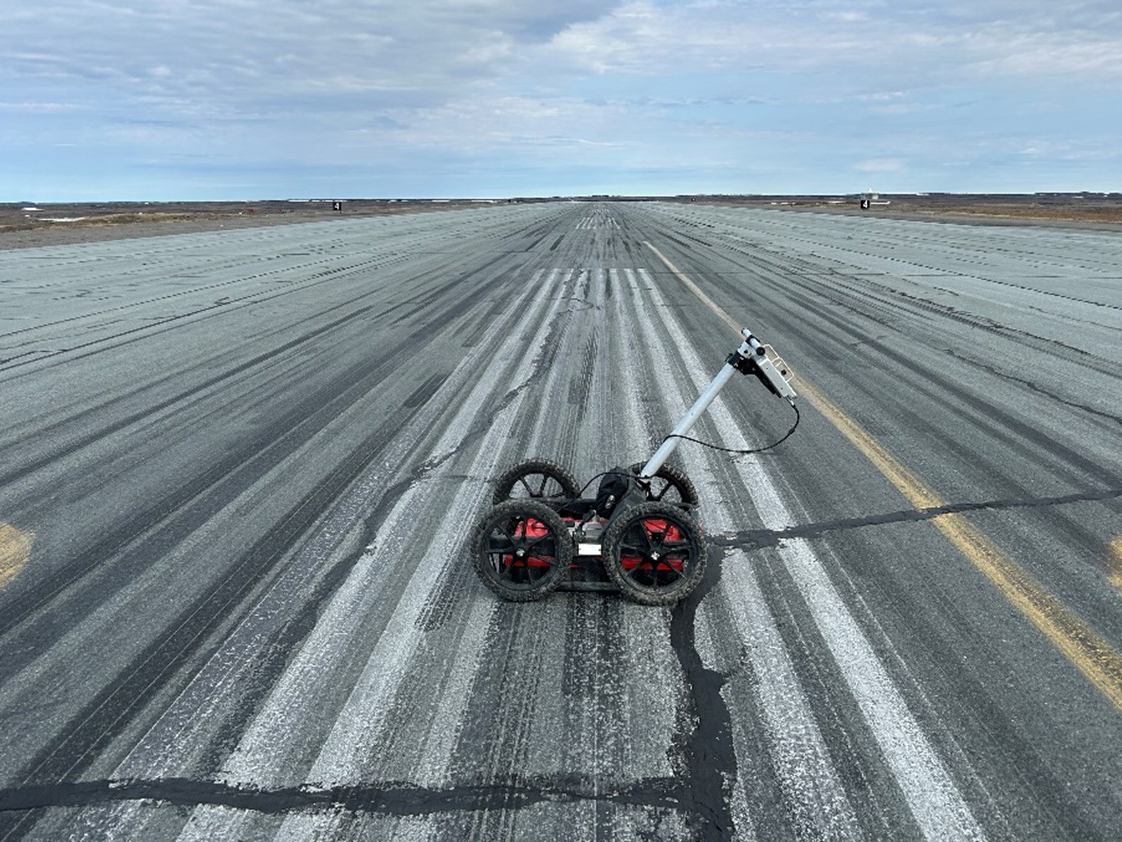
The project included pavement rehabilitation and geotechnical investigations for Runway 13-31, which is a 6000’ x 150’ asphalt paved runway, along with Phase I and II Environmental Site Assessments, a Hydrogeological Study, and a Snow and Wind Study. Dillon deployed their Light Detection and Ranging (LiDAR) UAV survey capabilities and with the increased survey efficiencies that it offers, were able to survey the entire airport property and the Rankin Inlet Hamlet. From this data Dillon developed a complete digital surface terrain model underlain by current aerial photo images, and subsequently developed comprehensive topographic maps which were used to analyze site drainage and pavement surface geometry. The LiDAR and aerial photo data was also used to compile heat maps of the frequency and severity of pavement cracking for a better visualization of the distribution thereof. Dillon also utilized a cost effective and non-invasive Ground Penetrating Radar (GPR) to further assess and characterize the extent of the major transverse cracks, pavement structure variations, groundwater depth, the potential presence of shallow rock formations or boulders, and to identify uniform pavement sections for consideration during the assessment of rehabilitation design options. To gain a better understanding of potential factors that may be contributing to the more severe transverse pavement cracking Dillon also studied the hydrogeology of the runway and surrounding environment to identify any potential contributing factors (i.e., the movement of ground and surface water and permafrost) underneath the runway and taxiways.
Geotechnical investigations were undertaken to characterize the existing pavement structure and supporting subgrade and included the installation of thermistors at predetermined locations across the runway to study the effect of the permafrost and the seasonal thaw/freeze cycles of the ground water and subsurface. The geotechnical investigations were compared to the GPR outputs, and the results were found to be consistent.
The innovative deployment of cost-effective, transformative digital data collection technologies like aerial LiDAR, photogrammetry, and GPR assessments greatly enhanced the understanding of the existing runway pavement structure and the surrounding environment, and minimized impact to airport operations in consideration of the fact that Rankin Inlet Airport is a critical transportation hub with a high number of daily air movements.
Awards
- Northwest Territories and Nunavut Association of Professional Engineers and Geoscientists, Award of Merit, 2024
Project Details
Project Partner: Government of Nunavut
Business Unit: Transportation
Service Offering: Emerging Services